Blanchland’s Bounder Roll of 1793
Records survive for three of Blanchland’s Riding of the Bounds which took place in 1793, 1812 and 1839. The documents are extremely useful for people researching family history as they contain the names of the men who took part, their ages at the time, the role they played in the proceedings and sometimes their occupation and where they lived.
A downloadable PDF transcription is available below. The PDF is only 26kB in size so is easy to download, and the text is laid out to print on nine sides of A4 paper.
As with the other two events, the 1793 Riding of the Bounds seems to have been a raucous affair, involving much eating of beef, drinking of ale and chasing round for scattered gingerbread at various points along the way. And one or two men must have nursed a few bruises after being lifted up and given ‘the bumps’ against the stone cairns or curricks which marked the boundaries!
Up on the hills above Blanchland the party had a superb view of Newcastle – so they must have had fine, clear weather for their two days out on the moors.
They also created a new placename on that day, for a boundary marker which still appears on today’s Ordnance Survey maps of the area. From the description of the location in the Bounder Roll, the currick (today’s spelling) at Grid Reference NZ946448 was intended to be known as Adams’ Currack. The original 1793 Bounder Roll is held at the Northumberland Archives at Woodhorn, Ashington, Northumberland.

Detailing the Bounder Roll
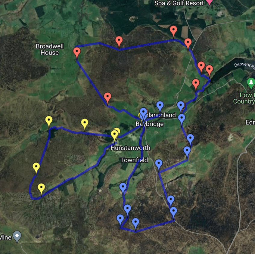
Click on the Google map below to see the routes of the two days’ ridings…